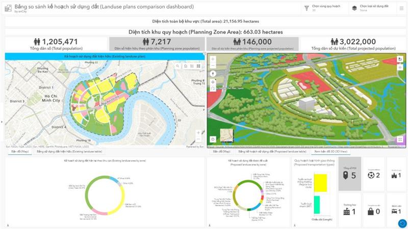
Mapper™ incorporates cutting-edge technologies to streamline geographic data management, enabling businesses to harness the full potential of spatial information. With an intelligent, integrated system, Mapper™ empowers users by automating processes, providing real-time updates, and facilitating timely decision-making—especially in high-stakes situations.
Built with a dynamic workflow, Mapper™ ensures optimal productivity and superior performance by making data-driven decisions and delivering accurate, actionable insights. Whether you're analyzing geographic features, managing large datasets, or sharing maps across teams, Mapper™ simplifies complex tasks while maintaining the highest standards of quality and efficiency.

- Enhanced Decision-Making
- Improved Data Accuracy
- Boosted Productivity
- Scalable and Customizable
- Simplified Collaboration
- Comprehensive Data Management
- Advanced Visualization
- Vector Data Editing
- 2D and 3D Rendering
- Geocoding
- Print Layouts
- Raster Data Analysis
- Database Connectivity
- Python Integration
Data Management
Mapping and Visualization
Geospatial Analysis
Integration Management
Customization Tools
Reporting and Notifications
Collaboration Tools
Data Management
Efficiently manage and organize large geographic datasets with powerful tools for data integrity and consistency.
Mapping and Visualization
Create dynamic, interactive 2D and 3D maps with customizable layers for insightful visual representation.
Geospatial Analysis
Perform advanced spatial analysis to uncover patterns, trends, and make data-driven predictions.
Integration Management
Seamlessly integrate and synchronize geospatial data with other business systems and platforms.
Customization Tools
Tailor the system’s features, map styles, and workflows to meet specific business needs.
Reporting and Notifications
Generate automated reports and receive real-time alerts to keep stakeholders informed.
Collaboration Tools
Share maps and data securely across teams for efficient, real-time collaboration.